
About the Project
Learn about Professor Emily Ritter and her vision for the First American Land Allotment Project
Meet the Project Director
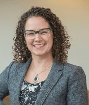
Professor Emily Ritter
PhD, Department of Political Science, Vanderbilt University
Professor Ritter's academic journey has been dedicated to exploring the intersection of human rights, political institutions, and historical justice. With a focus on how power dynamics shape policy outcomes, her research has provided crucial insights into the complex relationship between government actions and their impacts on marginalized communities.
At Vanderbilt University, she leads interdisciplinary research that bridges historical analysis with contemporary digital methodologies. Her work combines rigorous scholarship with accessible digital tools that make complex historical patterns visible to both academic and public audiences.
Origin of the Project
The First American Land Allotment Project began in Professor Ritter's seminar on political rights and historical justice. While examining case studies of land policy impacts, she and her students discovered significant gaps in accessible resources for understanding the transformation of Indigenous lands through federal policies.
"We kept encountering the same challenges," Professor Ritter explains. "The data existed in various archives and databases, but there was no comprehensive way for communities, researchers, or students to see and understand these land changes over time. The stories were there, but they needed to be made visible."
This realization led to an initial pilot project that mapped allotment patterns in one tribal nation. The positive response from both community members and fellow researchers convinced Professor Ritter of the need to expand the work into what has become the First American Land Allotment Project.
Vision and Approach
Professor Ritter's vision for the project emerged from her commitment to making historical justice visible and accessible. "Understanding land history is essential for addressing contemporary inequities," she notes. "But that understanding requires tools that help us see patterns and changes that occurred over decades or even centuries."
Her approach combines several key elements:
- Collaborative partnerships with tribal communities to ensure project work respects and incorporates Indigenous perspectives
- Integration of historical research with modern digital mapping technologies
- Development of interactive tools that allow users to explore complex historical data in intuitive ways
- Creation of educational resources that make this history accessible to diverse audiences
"This isn't just about documenting what happened," Professor Ritter emphasizes. "It's about creating tools that help us understand why it happened, how it impacted communities, and what it means for ongoing questions of land rights and tribal sovereignty today."
Impact and Future Direction
Under Professor Ritter's leadership, the project has grown from a classroom initiative to a comprehensive digital platform. To date, the team has mapped historical territories across multiple tribal nations, developed interactive story maps that have been used in educational settings from high schools to graduate programs, and created open datasets that support ongoing research in Indigenous studies.
Looking ahead, Professor Ritter envisions expanding the project to include more tribal territories, integrating oral histories and community knowledge into the digital resources, and developing new tools for visualizing the connections between historical land policies and contemporary issues.
"This is ongoing work," she explains. "We continue to learn from community partners, refine our approaches, and seek new ways to make this history accessible and meaningful. The ultimate goal is to create resources that serve both communities with direct connections to these histories and broader audiences who need to understand this critical aspect of American history."